Home
Home
About Geosun
About Geosun
Products
Products
- Hardware
- Mobile LiDAR Scanning System
- gCollector Road Information Collection System
- gSpin POS System
- PPK Solution
Support
Support
News
News
Contact Us
Contact Us


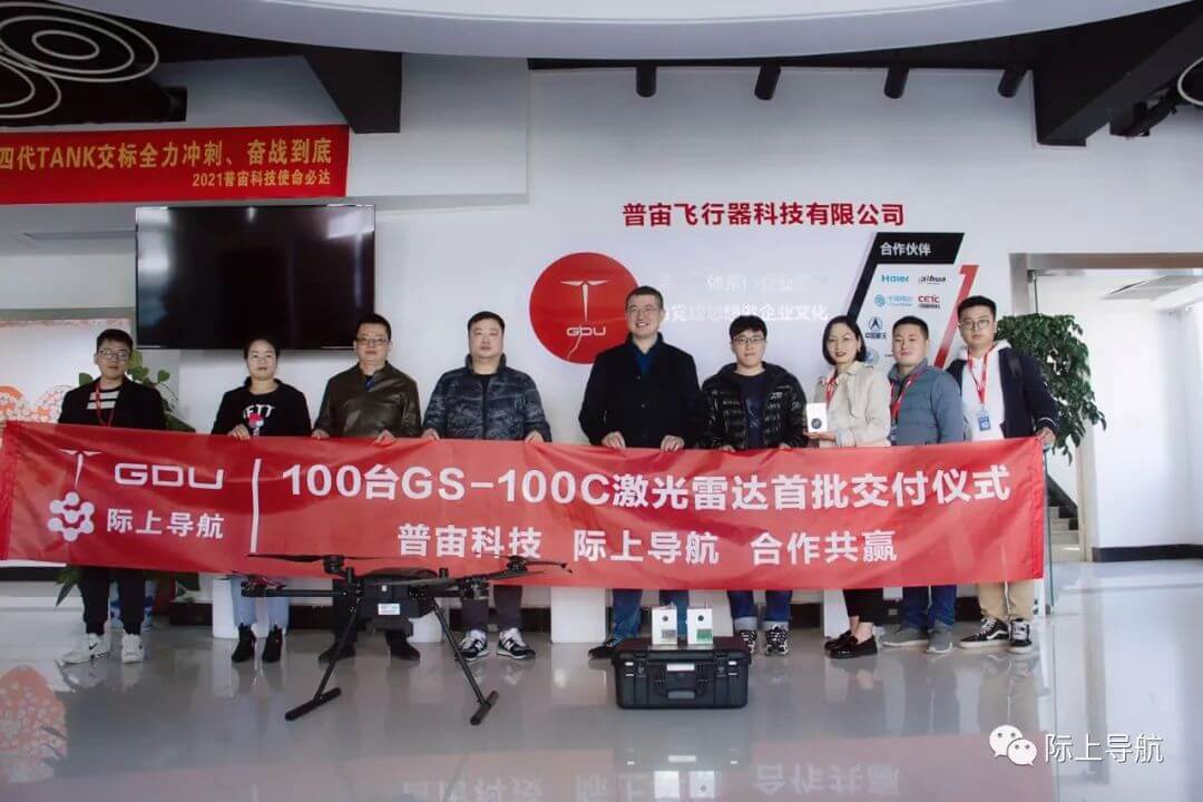
On the morning of November 25, 2021, Puzhou Technology, a subsidiary of Guide Infrared, and Geosun Navigation held a phased delivery ceremony for LiDAR scanning system at the Guide Infrared Industrial Park. The laser equipment delivered this time mainly consisted of the GS-100C+ short range LiDAR scanning system.

Geosun GS-100C+ LiDAR Scanning System
The GS-100C LiDAR scanning system is currently the most advanced ground observation system in the field of photogrammetry and remote sensing. This system integrates high-precision LiDAR scanners with inertial navigation systems. Due to its small overall size and light weight, it is suitable for data collection on various mobile platforms. As an advanced mobile measurement device that integrates various high-precision sensors, the GS-100C LiDAR scanning system can quickly and in real-time collect three-dimensional data of object surfaces, enabling professional, efficient, and accurate geographic information mapping, power line inspection, and other tasks.

Since 2009, the Geosun Navigation team has been dedicated to the field of airborne laser radar. Over the past decade, the company has accumulated rich experience and built a professional team in this field. It mainly serves industries such as land and resources, hydroelectric construction, intelligent transportation, precision agriculture, digital cities, and various types of complex terrain mapping. Currently, various types of short, medium, and long-range laser radar systems have been successfully developed, achieving remarkable results and receiving high recognition from industry colleagues.
Founded in Shenzhen in 2015, Puzhou Technology has now fully mastered the core technology of unmanned aerial vehicles (UAVs), achieving a "completely indigenous, independently controllable" research and development capability. It is one of the few domestic enterprises with capabilities in overall design, research and development, mass production, sales and maintenance, data services, education, and practice. With a focus on providing "high-end, professional, and customizable" system solutions, it offers unmanned equipment application solutions, including drones, infrared systems, intelligent inspections, data clouds, and service platforms, to 18 civil fields such as energy, environmental protection, and emergency response.
The collaboration with Puzhou Technology undoubtedly will contribute to the advancement of airborne laser radar technology. With Geosun Technology's expertise in unmanned aerial vehicles and Geosun Navigation's experience in laser radar systems, this partnership has the potential to drive innovation and further enhance the capabilities of airborne laser radar technology. It's exciting to see how this collaboration will unfold and the positive impact it will have on the development of cutting-edge technologies in this field.
URL:https://www.geosuntech.com/News/14.html
Previous:Return
Next:Geosun participated in the Second Electric Power Artificial Intelligence Conference


