Home
Home
About Geosun
About Geosun
Products
Products
- Hardware
- Mobile LiDAR Scanning System
- gCollector Road Information Collection System
- gSpin POS System
- PPK Solution
Support
Support
News
News
Contact Us
Contact Us

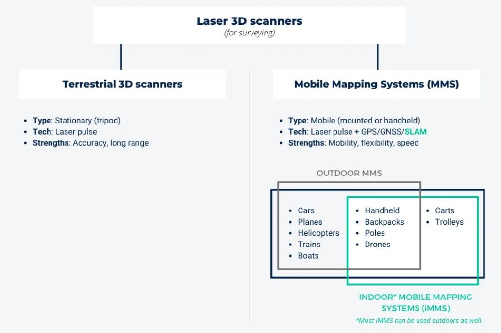
In the field of 3D scanning and spatial data acquisition, LiDAR (Light Detection and Ranging) technology is pivotal for capturing accurate and detailed spatial information. Among the various LiDAR systems available, handheld SLAM LiDAR and terrestrial LiDAR represent two prominent approaches, each with distinct advantages and use cases. This article will explore the differences between handheld SLAM LiDAR and terrestrial LiDAR, highlighting their respective strengths, limitations, and ideal applications.
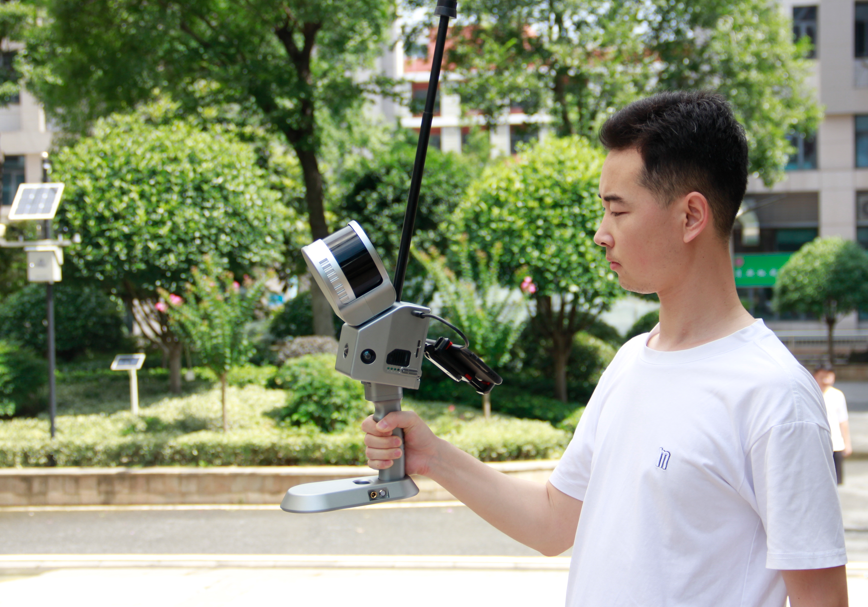
Handheld SLAM LiDAR systems combine LiDAR technology with SLAM (Simultaneous Localization and Mapping) algorithms in a portable format. These devices are designed to be carried by the user, enabling flexible and dynamic data collection in various environments. The integration of SLAM algorithms allows for real-time 3D mapping and localization, making these systems particularly useful for certain applications.

Portability and Flexibility: The primary advantage of handheld SLAM LiDAR is its mobility. These portable LiDAR scanners allow users to navigate and scan hard-to-reach areas, making them ideal for tasks that require high flexibility. This mobility is particularly beneficial in environments where space constraints or accessibility issues are present.
Real-Time Data Processing: One of the key features of handheld SLAM LiDAR is its ability to process data in real-time. The integration of SLAM algorithms enables the device to update the 3D map as the user moves, providing immediate feedback. This capability is crucial for applications that demand quick adjustments and detailed spatial analysis, such as construction site inspections and indoor mapping.
Ease of Use: Handheld SLAM LiDAR systems are often designed with user-friendly interfaces and automated processes, making them accessible to professionals across various fields. The simplicity of operation allows users to focus on data collection without the need for extensive technical training.
Data Accuracy and Resolution: While handheld SLAM LiDAR offers flexibility, it may not achieve the same level of accuracy and resolution as stationary systems. The quality of the data can be influenced by the user's movement and the environment, potentially affecting the precision of the 3D models.
Battery Life and Processing Power: Portable LiDAR scanners are limited by battery life and processing capabilities. Extended use may require frequent recharging or additional power sources, and the device's processing power might be constrained compared to larger systems.
Environmental Interference: Handheld SLAM LiDAR systems can be affected by environmental factors such as lighting and surface reflectivity. These conditions can impact the effectiveness of SLAM algorithms and the overall quality of the captured data.
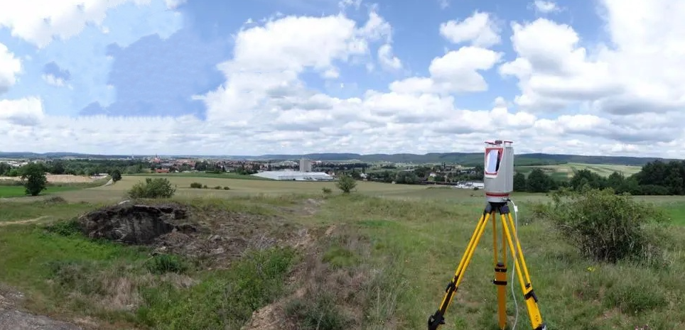
Terrestrial LiDAR systems involve stationary scanners positioned on the ground to capture high-resolution 3D data. These systems are commonly used for detailed surveying, architectural documentation, and infrastructure inspection. By remaining stationary, terrestrial LiDAR ensures a stable platform for collecting accurate and comprehensive spatial data.

High Accuracy and Resolution: Terrestrial LiDAR is renowned for its high accuracy and resolution, providing precise measurements and detailed 3D models. This level of detail is essential for tasks that require rigorous standards, such as engineering surveys and detailed architectural documentation.
Stable Data Collection: The stationary nature of terrestrial LiDAR systems ensures consistent and reliable data collection. This stability minimizes errors related to movement and allows for comprehensive data acquisition over time.
Rich Data Output: Terrestrial LiDAR can produce dense point clouds with high point density, resulting in rich and detailed 3D models. This capability is particularly useful for creating accurate digital representations of large or complex structures.
Lack of Mobility: One of the main limitations of terrestrial LiDAR is its lack of mobility. The system's stationary setup restricts its use to specific locations, which can be a disadvantage in dynamic or expansive environments where movement is needed for data collection.
Time-Consuming Setup: Setting up and calibrating terrestrial LiDAR systems can be time-consuming. Multiple scans from different positions may be required to cover an entire area, which can extend the time needed for data collection.
Environmental Factors: Although stationary, terrestrial LiDAR systems are still subject to environmental conditions such as weather and lighting. These factors can influence the quality of the data and may necessitate additional measures to mitigate their impact.
When choosing between handheld SLAM LiDAR and terrestrial LiDAR, it's important to consider the specific requirements of your project. Handheld SLAM LiDAR is best suited for environments where mobility and real-time data processing are crucial. Its ability to navigate and map complex or confined spaces makes it ideal for applications such as indoor mapping and dynamic inspections.
In contrast, terrestrial LiDAR excels in providing high-precision and detailed data in stable environments. Its stationary nature and ability to generate high-resolution 3D models make it ideal for tasks that require meticulous accuracy, such as surveying and architectural documentation.

Both handheld SLAM LiDAR and terrestrial LiDAR offer unique advantages tailored to different applications. By understanding the strengths and limitations of each LiDAR technology, professionals can make informed decisions to select the most suitable solution for their spatial data acquisition needs. Whether you need the flexibility of a portable device or the precision of a stationary system, both technologies play a crucial role in advancing the field of 3D scanning and spatial analysis.
URL:https://www.geosuntech.com/News/233.html
Previous:Choosing Between Total Station and GNSS RTK Receiver: A Comprehensive Guide
Next:Comparing SLAM and GNSS: Choosing the Best Technology for LiDAR Surveying


