
Home
Home
About Geosun
About Geosun
Products
Products
- Hardware
- Mobile LiDAR Scanning System
- gCollector Road Information Collection System
- gSpin POS System
- PPK Solution
Support
Support
News
News
Contact Us
Contact Us

LiDAR, short for Light Detection and Ranging, is an emerging LiDAR scanning technology used in surveying applications. It integrates three key technologies: laser ranging systems, Global Positioning Systems (GPS), and Inertial Navigation Systems (INS). This integration has resulted in significant advancements in the real-time acquisition of three-dimensional spatial information. LiDAR provides a novel technical means for obtaining high-resolution spatial information in terms of both time and space. It is considered the most advanced surveying technique in the field today.
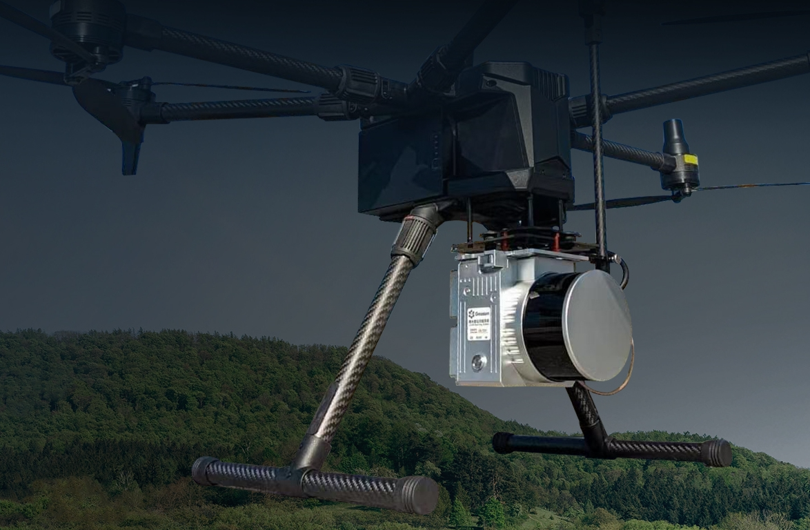
Digital Surface Model (DSM): The DSM accurately represents the terrain and surface features, making it suitable for generating true orthoimages and digital 3D models.
Digital Orthophoto (DOM): Using a Digital Elevation Model (DEM), the DOM corrects the digital aerial image pixels and creates image results generated by image mosaicking. It provides rich and intuitive information, with good interpretability and measurability, allowing direct extraction of natural and socio-economic information.
Digital Elevation Model (DEM): By extracting ground data from LiDAR-derived 3D point clouds, a digital elevation model can be generated.
Digital Line Graph (DLG): By utilizing LiDAR point clouds and DOM images, DLG products at large scales (1:500 to 1:2000) can be rapidly produced, reducing field survey work and significantly improving mapping efficiency. It can increase mapping efficiency by 5% to 20% compared to traditional manual field surveys.
From flight design to data acquisition to the processing of final products, the level of automation is very high. Real-time flight trajectory is displayed through GPS technology. There is no risk of missing data, thus avoiding human errors.
LiDAR can obtain target information with a resolution smaller than remote sensing or radar imagery. It can penetrate vegetation cover to acquire ground point data.
LiDAR measurement is an active sensing method that emits and receives laser pulses. It can penetrate dense vegetation and reach the ground, without being limited by lighting conditions or shadows. The obtained digital elevation model (DEM) closely represents the true surface morphology. LiDAR technology is highly accurate and suitable for capturing large areas, combining the characteristics of aerial photogrammetry and laser ranging. It is the optimal choice for obtaining high-precision digital elevation model data over large regions.
LiDAR systems directly acquire the coordinates of ground 3D point clouds and the orientation elements of imagery. They require little to no ground control points, enabling direct production of DEM and digital orthophoto maps (DOM). Compared to traditional aerial surveying and stereoplotting, LiDAR significantly reduces the workload for map production by around 30% to 50% and decreases the compilation workload by approximately 50%. This greatly shortens the overall work cycle.
LiDAR point cloud data is the most direct data product in LiDAR technology. The density and accuracy of point cloud data are relatively high, and they can quickly display the three-dimensional coordinates of points. By manually or automatically classifying, filtering, or removing point clouds from targets such as terrain outside vegetation or buildings, a triangulated irregular network (TIN) can be constructed to obtain DEM promptly. Due to the high density of LiDAR points, the generation of DEM is more convenient and accurate.
The products of basic surveying mainly include digital elevation models (DEM), digital orthophoto images (DOM), digital line graph maps (DLG), and digital raster maps (DRG). Regardless of the generation of any of these products, they require the assistance and guidance of high-precision three-dimensional information. Digital photogrammetry is complex and requires strict pre-preparation and technical planning. It requires technical personnel to have proficient operating skills. However, the data and three-dimensional coordinates obtained through LiDAR technology can achieve the high-precision image differential correction required for the production of DOM, making the production process more simplified and no longer relying on digital photogrammetry. It can be achieved in general remote sensing image processing systems.
LiDAR has strong penetration ability. Its good unidirectionality allows it to pass through narrow gaps and reach the ground surface, thereby obtaining accurate ground elevation in forest-covered areas. The commercial application of airborne LiDAR systems initially focused on the forestry industry because accurate data on forest cover and the underlying terrain are required for forest management and land administration. Traditional techniques have difficulty in obtaining precise information on tree height and tree density. Unlike satellite imaging, airborne LiDAR systems can simultaneously obtain the height of trees when surveying the terrain under the tree canopy.
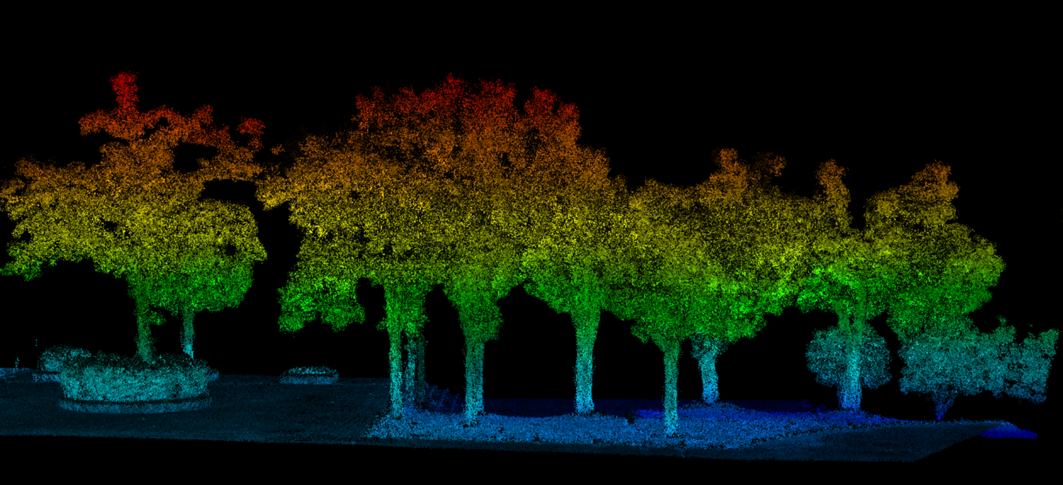
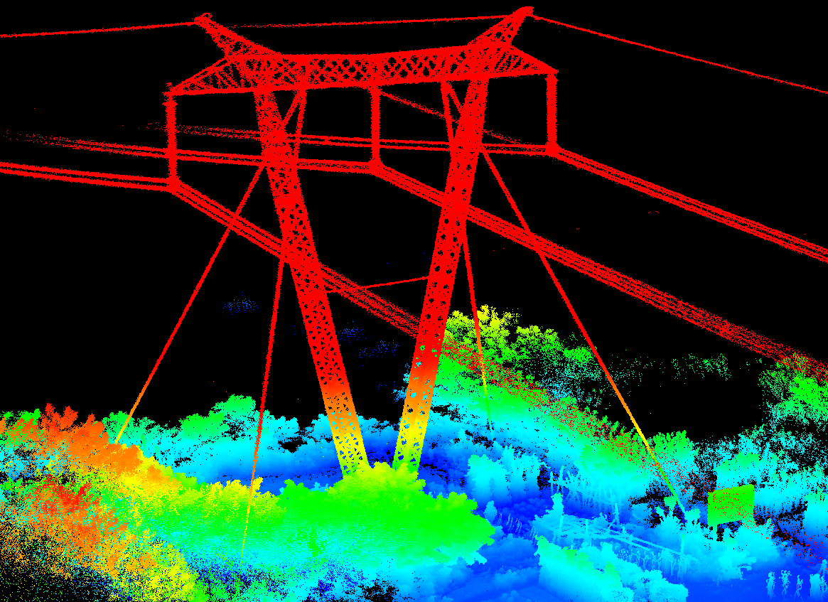
For engineering surveying, high-precision three-dimensional coordinate information of the surveying targets needs to be collected, and even more accurate three-dimensional object models may need to be established. Examples include power line inspections, measurements of tunnels and mines, hydrological surveys, and other fields. Both ground-based and airborne LiDAR are the best methods for solving these practical problems. Utilizing digital images and texture information, the construction of three-dimensional models based on structures can provide important foundations for landscape analysis, planning decisions, deformation measurements, and object preservation.
Currently, various industries are pursuing digitalization of their respective businesses. In a digital city, spatial information plays a crucial role as the foundational framework and platform for its construction. LiDAR systems can effectively acquire high-resolution and high-precision digital terrain models and digital orthophoto images, providing valuable spatial information resources for cities and playing a significant role in urban development.
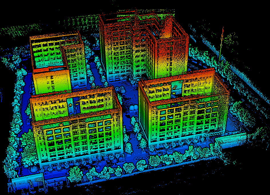
Digital cities also require the construction of high-precision, true three-dimensional, measurable, and realistic city models as virtual platforms for city management. However, traditional techniques for urban 3D modeling are time-consuming, inefficient, and often yield subpar results, directly impacting the breadth and depth of digital city services. By using LiDAR technology to conduct airborne LiDAR scanning or ground-based multi-angle LiDAR scanning of buildings and terrain, high-density and high-precision three-dimensional point coordinates of targets can be rapidly obtained. Point cloud data can then be used to construct models and apply texture mapping with software support, enabling the creation of large-scale urban 3D models from various perspectives. Additionally, rapid and dynamic updates can be implemented, providing a reliable foundation for the continuous and historical development of basic data sources for digital city construction.
Some LiDAR technologies utilize two different wavelengths of LiDAR beams to measure underwater terrain. By using red light (or infrared light) to measure the water surface while penetrating the water with blue-green light to measure the underwater terrain, the depth of the water can be calculated based on the time difference between the two received beams. This enables large-scale underwater terrain mapping. Generally, Lidar can measure the depth of seawater up to 50 meters, which varies with the clarity of the water. It is widely applied in industries such as navigation channels, nearshore marine environments, and hydrology.
Currently, mines and the cities associated with mining face significant challenges. Overexploitation directly leads to environmental problems, and excessive mining depletes resources. Additionally, internal factors within mining operations and their impacts on people, machinery, materials, methods, and the environment must be considered. Strengthening the construction of digital mining is an effective approach to address these challenges from multiple perspectives, aiming for a comprehensive solution.
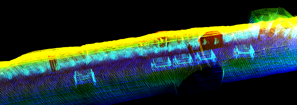
LiDAR technology can be used to rapidly collect data across the entire mine and construct three-dimensional models, which better represent its form. Each component has different considerations during modeling. Generally, the construction should be done in a layered manner, and multidimensional evaluations should be conducted, primarily focusing on environmental, economic, and natural disaster assessments. This enables efficient data feedback, providing continuous data availability 24 hours a day and ensuring the clarity and rationality of the overall model construction. Additionally, it facilitates the prediction and assessment of potential future accidents, helping prevent them proactively.
LiDAR scanning systems operating on airborne platforms are most suitable for measuring transmission lines. Aircraft can adjust their altitude and speed as needed to obtain more accurate data. By simultaneously using video recorders, digital cameras, and other sensors in the LiDAR scanning application platform, both LiDAR scanning measurements and line inspection and mapping work can be conducted synchronously.
URL:https://www.geosuntech.com/News/222.html
Previous:Research Report on Global Handheld 3D LiDAR scanner Market


