Home
Home
About Geosun
About Geosun
Products
Products
- Hardware
- Mobile LiDAR Scanning System
- gCollector Road Information Collection System
- gSpin POS System
- PPK Solution
Support
Support
News
News
Contact Us
Contact Us

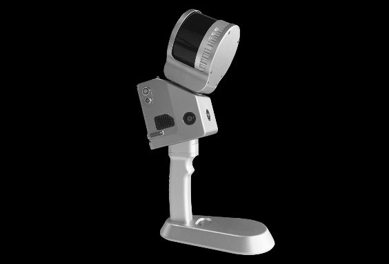
In recent years, the handheld LiDAR scanner has emerged as a powerful tool for capturing precise and detailed 3D data. This portable device utilizes laser technology to revolutionize surveying and mapping to create precise digital terrain models, monitor changes in landscape, and assist in infrastructure planning. Additionally, they aid in forestry management, archaeology, environmental monitoring, construction, and even augmented reality applications.

How Does a Handheld LiDAR Scanner work and How to Use it?
The working process of a 3D scanner involves three main steps: data acquisition, processing, and refinement.
During data acquisition, the scanner utilizes a laser or structured light source to capture the geometric information of the object. The emitted light interacts with the object's surface, and the scanner's sensor captures the reflected light. This collected data forms the basis for creating a 3D model.
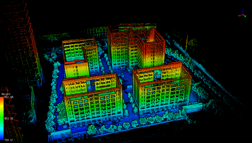
Next, the acquired data undergoes processing to generate a comprehensive 3D model. Raw data is converted into a point cloud, which contains precise information about the object's position and surface details. This transformation allows for a digital representation of the object's shape and structure.
Once the initial 3D model is generated, it can be refined and enhanced using specialized software. This refinement process involves tasks such as smoothing out rough surfaces, filling in gaps or holes in the model, and adding additional details to improve its accuracy and visual appeal. The end result is a highly accurate and detailed digital representation of the scanned object.
Watch the following video to learn how to use our GS-100G handheld LiDAR scanner:
Why use the Handheld LiDAR Scanner?
The handheld LiDAR scanner offers numerous advantages and benefits, making it a valuable tool across various industries. Here are some key reasons why the handheld LiDAR scanner is widely used:
Portability and Accessibility: Unlike traditional LiDAR systems that are typically large and stationary, handheld LiDAR scanners are compact, lightweight, and portable. This mobility allows users to easily navigate and scan in various environments, including challenging or hard-to-reach areas. The scanner's portability ensures accessibility and flexibility in data collection.
High Precision and Accuracy: Handheld LiDAR scanners provide exceptional precision and accuracy in capturing 3D data. They can generate high-density point clouds with millions of data points, resulting in detailed and accurate representations of the scanned objects or environments. This level of precision is crucial for applications such as surveying, mapping, and infrastructure planning.
Rapid Data Acquisition: Handheld LiDAR scanners enable fast data acquisition, significantly reducing the time required for data collection compared to traditional surveying methods. With their real-time scanning capabilities, users can quickly capture vast areas or objects, allowing for efficient project completion and increased productivity.
Versatile Applications: The handheld LiDAR scanner finds applications in a wide range of industries. It is utilized in surveying and mapping for creating digital terrain models, monitoring land changes, and conducting volumetric analysis. It is also employed in construction for quality control, progress monitoring, and as-built documentation. Additionally, it aids in forestry management, archaeology, infrastructure inspection, virtual reality, and more.
Improved Safety: By enabling remote data capture, handheld LiDAR scanners enhance safety in various scenarios. They allow users to collect data from hazardous or inaccessible areas without putting personnel at risk. This capability is particularly valuable in industries such as mining, oil and gas, and emergency response, where safety is a primary concern.
Cost and Resource Efficiency: Handheld LiDAR scanners offer cost and resource savings compared to traditional surveying methods. They reduce the need for extensive fieldwork, minimize manual measurements, and streamline data collection processes. This efficiency translates into reduced labor costs, increased project throughput, and optimized resource allocation.

How to Choose the Best Handheld LiDAR Scanner?
Choosing the best handheld LiDAR scanner involves considering several important factors. Here are some key points to guide you in the selection process:
Accuracy and Range: Look for a handheld LiDAR scanner that offers high accuracy and a suitable range for your intended applications. Consider the scanner's maximum range and its ability to capture precise data in various conditions.
Data Quality: Assess the scanner's data quality specifications, such as point density, point cloud resolution, and noise levels. Higher data quality ensures more detailed and reliable results.
Portability and Ease of Use: Handheld LiDAR scanners should be lightweight, compact, and easy to operate. Consider factors such as size, weight, ergonomics, and the user interface to ensure convenient and efficient scanning.
Battery Life: Check the scanner's battery life and charging options. Look for a device that can sustain extended scanning sessions without frequent recharging.
Integration and Connectivity: Consider the scanner's ability to integrate with other systems or devices, such as GPS receivers or external sensors. Connectivity options like Wi-Fi, Bluetooth, or USB can enhance data transfer and collaboration.
Price and Value: Evaluate the scanner's price in relation to its features and performance. Consider your budget and the return on investment (ROI) you expect from the scanner's capabilities.
Application Compatibility: Ensure that the scanner is suitable for your specific applications, such as surveying, construction, forestry, or archaeology. Some scanners may excel in certain industries or use cases more than others.
Remember to follow any additional recommendations or guidelines provided by the scanner manufacturer to achieve optimal results. Regularly maintain and calibrate the scanner to ensure its accuracy and performance over time.
URL:https://www.geosuntech.com/News/217.html
Previous:How Semi-solid-state LiDAR Realize Obstacle Detection in Intelligent Driving
Next:Unlocking Challenging Environments: Exploring Our Handheld LiDAR Applications


