1. Survey Area
Survey Area
2. Outcome Figure
The LiDAR data of this point has been processed indoors, resulting in a ground model after vegetation removal. A series of high-precision DEMs and other figures were produced based on this. By closely observing and rotating these figures and the three-dimensional point cloud model from multiple perspectives, combined with high-resolution remote sensing images and existing survey data, this investigation identified two landslides.

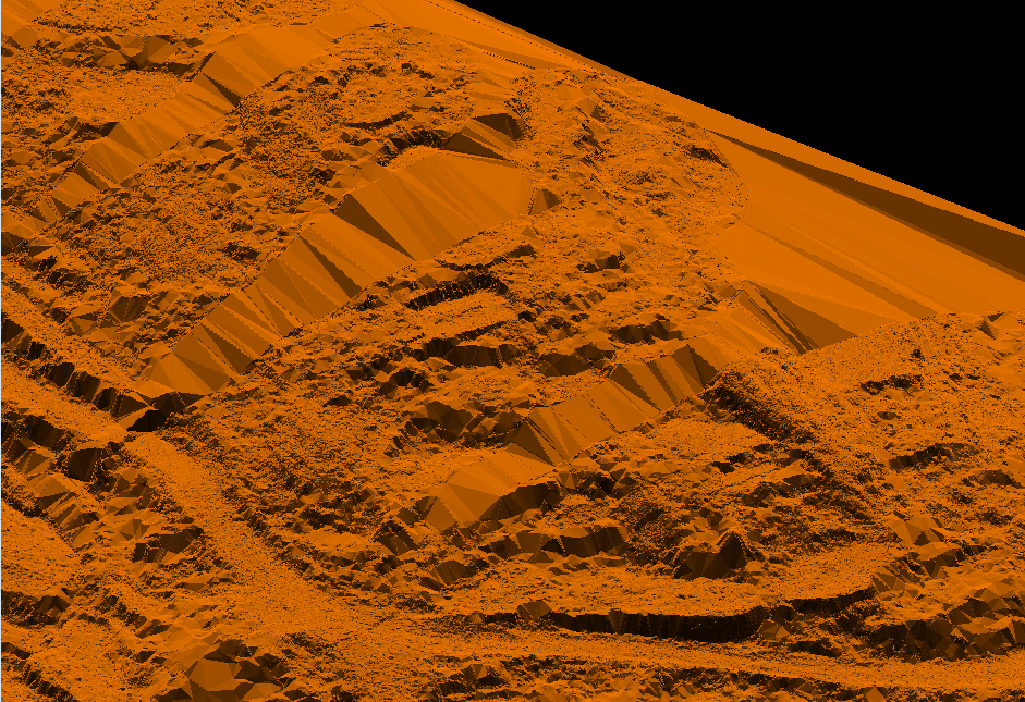
Shaded Relief Map of the Survey Area
Schematic Diagram Showing the Position of Landslide Profiles
Landslide Cross-Section Diagram B-B’
3. Comprehensive Analysis of Geological Hazard Risks
It can be observed that there are two arc-shaped landslides along the roadside, both roughly aligned with the direction of the road. The slope of the slope is steep, with several terraces, and the maximum terrace height reaches 11.2 meters. There are no obvious deformation signs such as tension cracks caused by landslides at the rear edge of the landslides. However, due to the steep slope and significant terrain fluctuations of the landslide, there is a possibility of continued deformation under the influence of human engineering activities, as well as natural factors such as rainfall and weathering.
It is evident that utilizing the characteristics of secondary returns of LiDAR (after filtering to remove surface vegetation information) enables the extraction of ground information regarding slope deformation signs (such as cracks) in vegetated areas of low hills and hills. This approach facilitates the early identification of geological hazard risks and is highly practical and innovative. It can provide extremely effective technical support for detailed ground investigations of geological hazards, particularly in densely vegetated areas.