
Home
Home
About Geosun
About Geosun
Products
Products
- Hardware
- Mobile LiDAR Scanning System
- gCollector Road Information Collection System
- gSpin POS System
- PPK Solution
Support
Support
News
News
Contact Us
Contact Us

Handheld LiDAR (Light Detection and Ranging) technology has revolutionized the way we map and navigate through challenging environments. By utilizing laser beams to measure distances and create high-resolution 3D models, handheld LiDAR devices have proven to be invaluable tools in mapping various difficult terrains. In this article, we will explore the applications of handheld LiDAR in mapping environments such as staircases, mines, garages, parks, forests, and power lines.
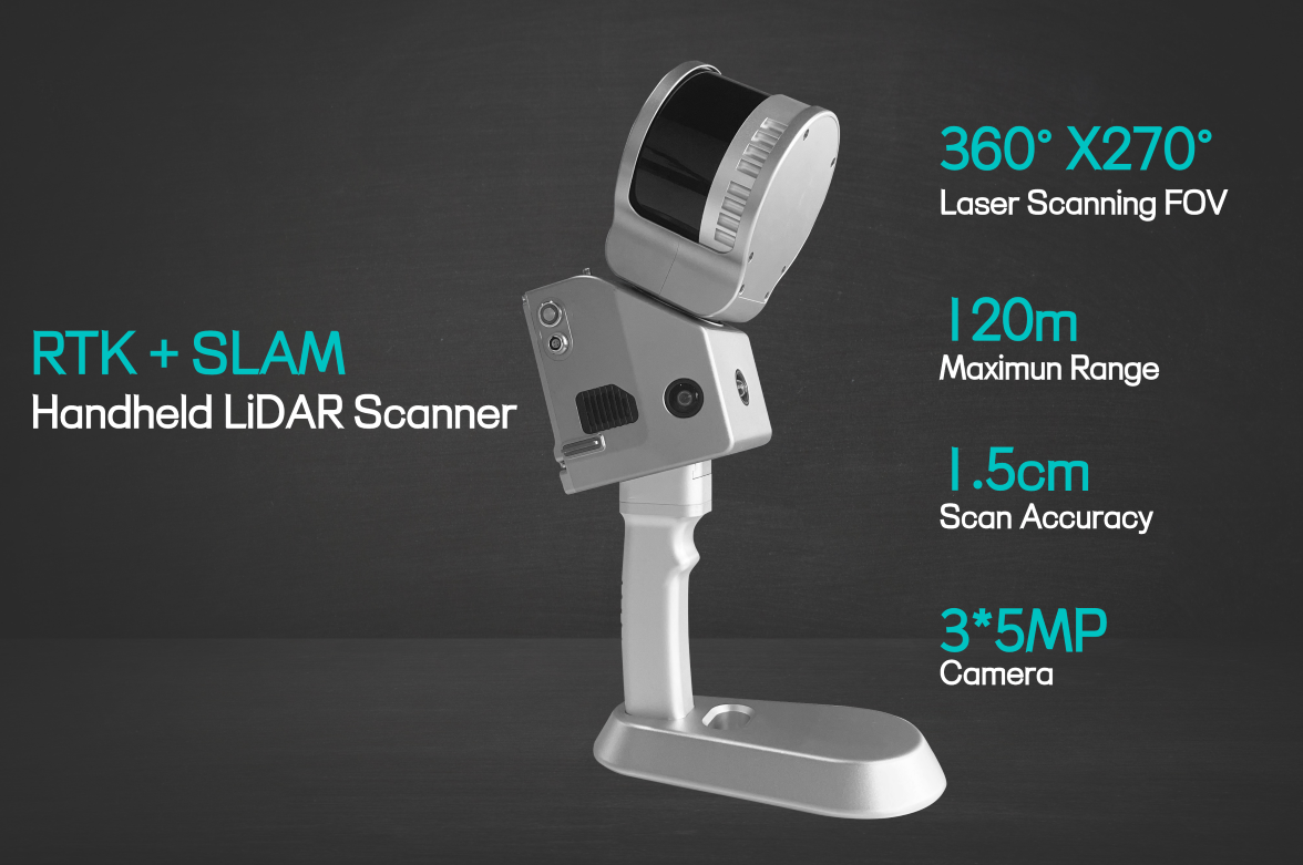
Mapping Mines
The underground environment of mines poses numerous challenges for mapping and exploration. Handheld LiDAR offers a solution by providing real-time 3D mapping capabilities. Its ability to penetrate darkness and dust allows for the creation of accurate maps, aiding in mine planning, safety assessments, and optimizing mining operations.
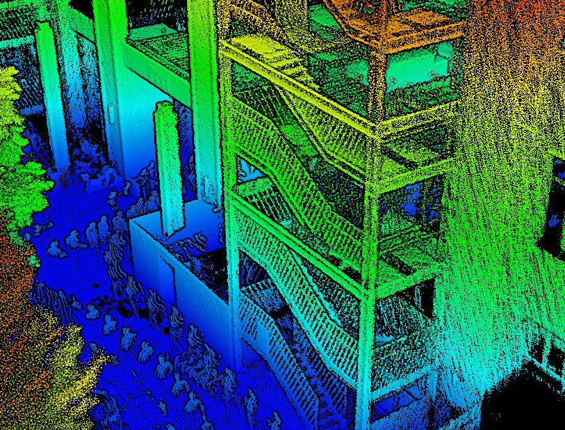
Mapping Staircases
Handheld LiDAR devices are instrumental in mapping staircases, especially in complex building structures. By capturing precise measurements and generating detailed point clouds, LiDAR enables accurate modeling of staircases' dimensions, angles, and surface irregularities. This data can be utilized for architectural design, renovation projects, and improving accessibility in public spaces.
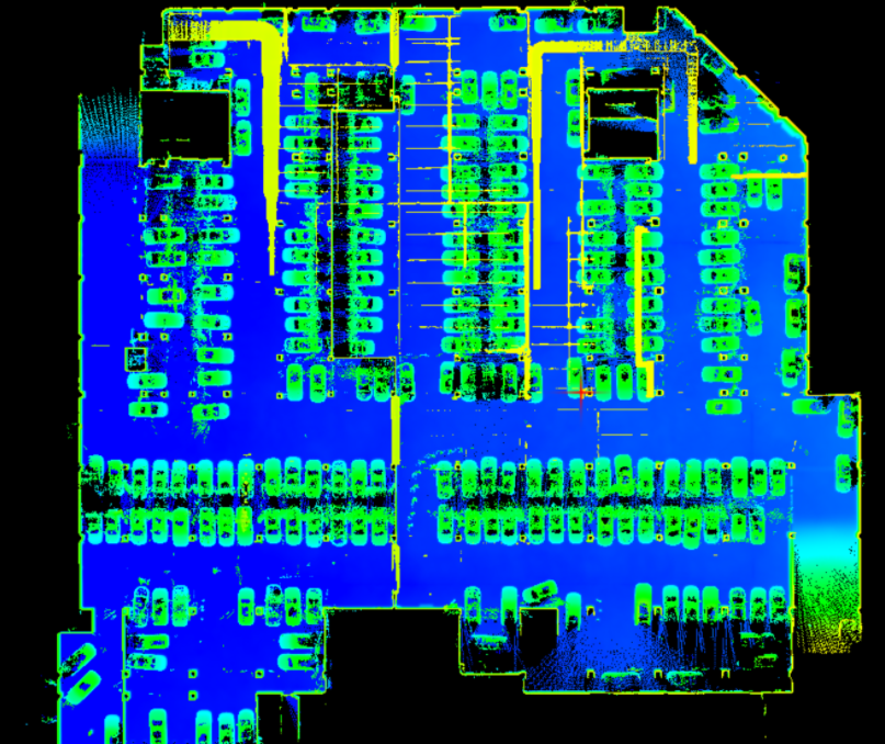
Mapping Garages
Navigating through congested parking garages can be a daunting task. Handheld LiDAR scanners offer a practical solution by quickly mapping the garage's layout, including columns, walls, and parking spaces. This data can be integrated into navigation systems, enabling drivers to find available parking spaces efficiently and reducing traffic congestion.
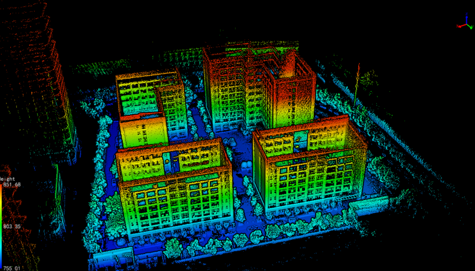
Mapping Industrial Parks
Industrial parks often consist of complex structures and large areas that require efficient mapping solutions. Handheld LiDAR technology allows for the rapid scanning and mapping of industrial park environments. This data provides valuable information for infrastructure planning, site management, and optimizing logistics within the park.
Mapping Power Lines
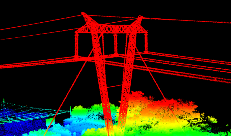
Handheld LiDAR scanners play a vital role in mapping power lines, particularly in challenging topographies. Traditional methods often involve risks for workers, such as climbing utility poles. With LiDAR, power line inspections can be conducted remotely, capturing precise measurements of the power lines' position, sag, and vegetation encroachments. This information facilitates maintenance planning, reducing downtime and improving safety.
Conclusion
Handheld LiDAR technology has opened up new possibilities for mapping difficult environments. From staircases and mines to garages, parks, forests, and power lines, these devices enable faster, safer, and more accurate data collection. The applications discussed in this article demonstrate the potential of handheld LiDAR in various industries, contributing to improved planning, enhanced safety, and efficient utilization of resources. As technology continues to advance, we can expect further innovations and expanded applications of handheld LiDAR in mapping challenging environments.
URL:https://www.geosuntech.com/News/218.html
Previous:Everything You Need to Know About the Handheld LiDAR Scanner
Next:Research Report on Global Handheld 3D LiDAR scanner Market


