Home
Home
About Geosun
About Geosun
Products
Products
- Hardware
- Mobile LiDAR Scanning System
- gCollector Road Information Collection System
- gSpin POS System
- PPK Solution
Support
Support
News
News
Contact Us
Contact Us


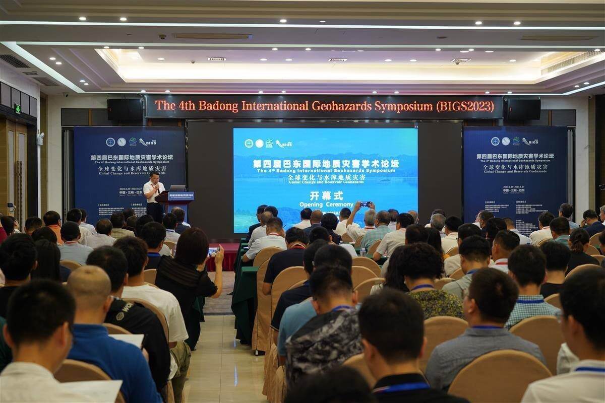
On August 27th, the Fourth Badong International Symposium on Geological Disasters (BIGS2023) opened at the Eastern Saint Jiuzhou International Hotel in Badong. More than 400 experts, scholars, and graduate students from 25 countries and regions including the United States, Austria, Germany, Italy, and Australia attended the conference to explore new approaches to geological disaster prevention and control.

During the period, experts and scholars presented academic reports on the theme of "global change and geological disasters in reservoir areas." The discussions covered a wide range of topics including the evolution process of geological disasters, the development of technologies and equipment for geological disaster prevention and control, big data and artificial intelligence in geological disasters, and intelligent multi-field monitoring of geological disasters. The aim was to explore global change and the prevention and control of geological disasters in reservoir areas, and to further promote international exchange and cooperation in the field of geological disasters.

During the meeting, Geosun and experts and scholars from both domestic and international arenas engaged in discussions on the theme of "Application of Unmanned Aerial Vehicle LiDAR Technology in Geological Disasters.

We introduced the technology and applications of UAV LiDAR to geological experts. UAV LiDAR scanning systems can be used for pre-disaster warning, emergency response during disasters, and post-disaster assessment in geological disasters. By conducting multiple scans and 3D modeling of target areas with LiDAR scanning systems, we can compare the results of multiple scans to analyze trends in geological surface changes and predict disasters. During disasters, rapid modeling can be achieved through unmanned aerial vehicle LiDAR scanning systems, providing real-time descriptions of disaster dynamics and development for emergency departments to reference in decision-making, thereby reducing disaster losses. After disasters, drones can assess disaster losses through 3D modeling, providing basic data for disaster reconstruction.
Moreover, the LiDAR beam can penetrate the gaps between leaves to obtain real three-dimensional surface data, effectively performing "CT scans" of mountainous terrain. By filtering out surface vegetation, real three-dimensional terrain can be obtained, enabling geological experts to interpret geological disasters. This address challenges in investigating and identifying hidden geological disaster hazards in high-altitude, remote, and concealed areas within disaster-stricken areas.
Therefore, the role of LiDAR technology in the early identification of geological disasters is increasingly prominent and has been vigorously promoted by various levels of management departments and industry experts. On the other hand, LiDAR can also be used for detailed measurement of buildings themselves, generating high-precision three-dimensional models, which provide important basis for investigating and evaluating building damage, land space planning and utilization, urban three-dimensional modeling, etc.
URL:https://www.geosuntech.com/News/24.html
Previous:Geosun Cooperation with Aceinna for Autonomous Vehicles


